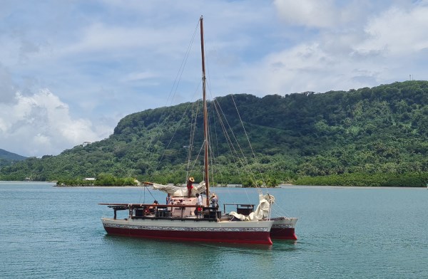
I recently hosted two Kiwi crew of the Okeanos Messenger on its journey to New Zealand, rekindling my interest in traditional Pacific navigation.
GPS navigation gets us safely to places and saves our special spots, however Pacific communities have used their own system, unchanged for thousands of years.
All data is stored inside the head of a master navigator, who has spent a lifetime training and using the stars, sun, moon, currents, wave action, wind, birds and even the taste of the water to get them efficiently to their destination.
They learn the sea currents and expected variation in wave patterns of all places they intend to travel. Once proficient they are at one with the marine environment, understanding how the elements are interwoven on their intended journey and subtle changes cause them to make course alterations.
COG (course over ground) is complex and involves an ancient star compass, which they were originally taught on coral sands with shells and a stick. The cardinal points of NESW, as well as four quadrants that fall between each cardinal point are identified. 360° is divided into 32 houses of 11.25° each and signify where a particular star rises in the east and sets in the west as they always rise and fall in the same house. They need to identify and memorise over 220 stars, where the sun rises and sets throughout the year as well as which stars are used to travel to each island. These were learnt through rote, chants, songs and dances.
SOG (speed over ground) is calculated by timing spray from the bow to see when it passes the stern. Speed is required to estimate both distance travelled, distance to go and ETA.
Their LCD is the night sky along with the sunrises and sunsets. Stars only provide accurate positioning until they rise to 45° on the horizon or dip below this as they set, once outside this zone they defer to the closest stars but need to constantly make mental adjustments.
They will use both rising and setting stars to keep on course as well as stars lined up with the port and starboard rigging ropes to ensure they are constantly on track. To measure distance travelled and latitude they identify pairs of stars that travel perpendicular to the meridian line between north and south.
Adjustments are made at sunrise and sunset but cloudy skies forces them to use dead reckoning pointing the angle of the bow into the swell to stay on course until the skies clear. In the past 50 years they have made numerous trips between Hawaii, Easter Island and New Zealand and everywhere in between.
Bloodshot eyes identify the on-board navigator as they constantly have little sleep and can be woken by a simple change in the motion of the vessel that tells them they are off course.
Mau Piailug, of Satawal Atoll, FSM, was the only one of six remaining Master Navigators prepared to break the cultural taboo by teaching outsiders this sacred skill. Driven by his strong belief that if not shared it would be lost forever, what he started has resulted in hundreds being taught and the number grows every year.